
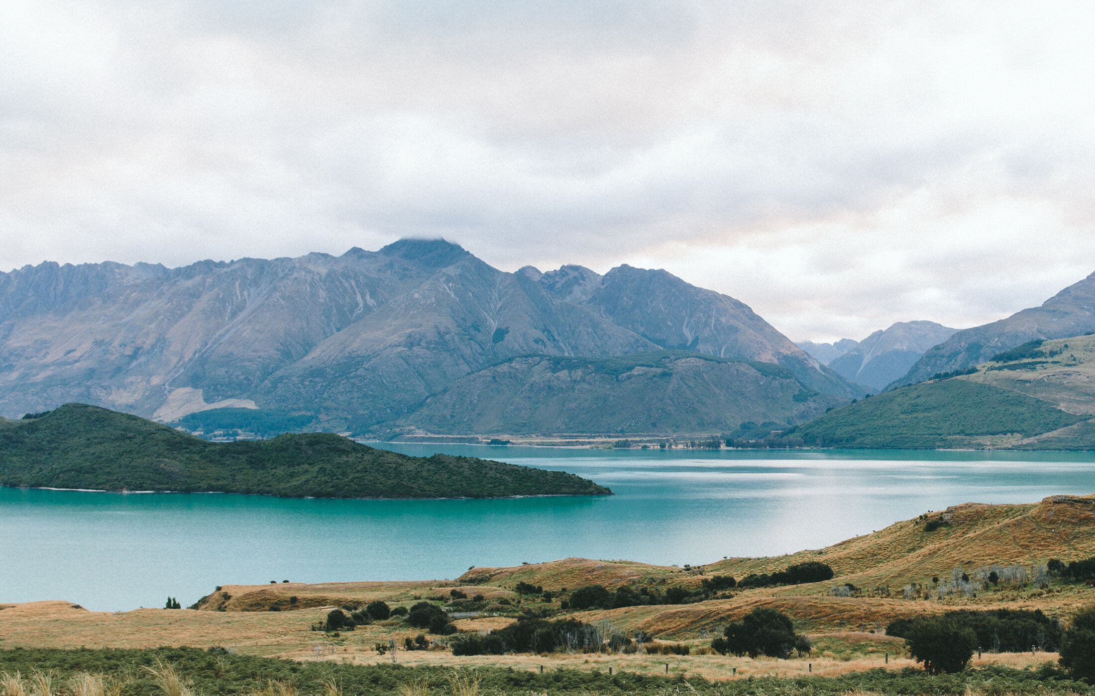
Aerial Survey/Mapping
At Elev8 Visions, we deliver accurate, data-rich mapping solutions to support critical decision-making in construction, mining, utilities, and land development. Using state-of-the-art drones, RTK workflows, and survey-grade methodologies, our aerial mapping provides fast, reliable results at a fraction of the time and cost of traditional surveying.
-
Aerial Survey/Mapping
Our drones capture large-scale areas quickly, producing detailed, geo-referenced datasets.
Cover expansive sites in hours, not days
Safely map areas inaccessible by foot or vehicle
Consistent, repeatable data collection for progress tracking
Ideal for construction sites, quarries, land development, and environmental studies
-
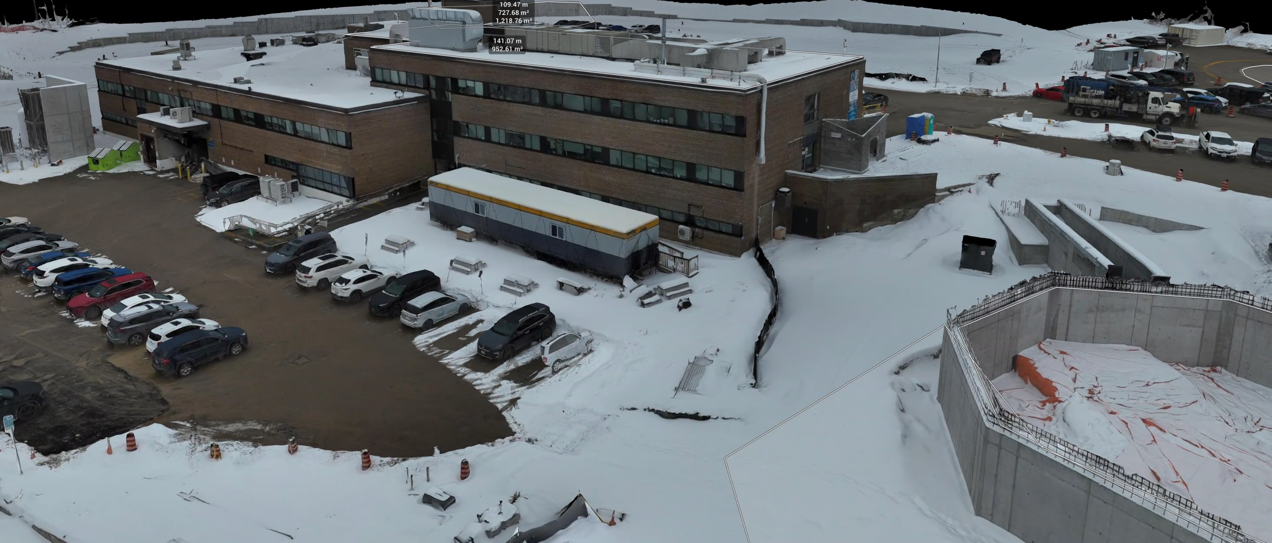
3D Mapping & Digital Twins
Turn real-world assets and terrain into fully interactive 3D models.
Create highly accurate 3D meshes and point clouds
Support BIM (Building Information Modeling) workflows
Generate elevation profiles, volumetric measurements, and slope analyses
Visualize complex projects in true-to-life scale for planning and reporting
-
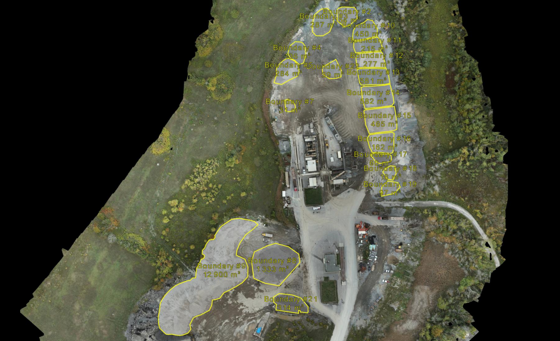
Volumetrics & Cut/Fill Analysis
Accurate volume measurements are critical for managing resources and costs. Our drone-based volumetric analysis delivers results you can trust.
Measure stockpile volumes of aggregates, ore, soil, and waste
Calculate cut-and-fill quantities for earthworks projects
Reduce disputes with defensible, survey-grade data
Faster, safer, and more cost-effective than manual measurement methods
-

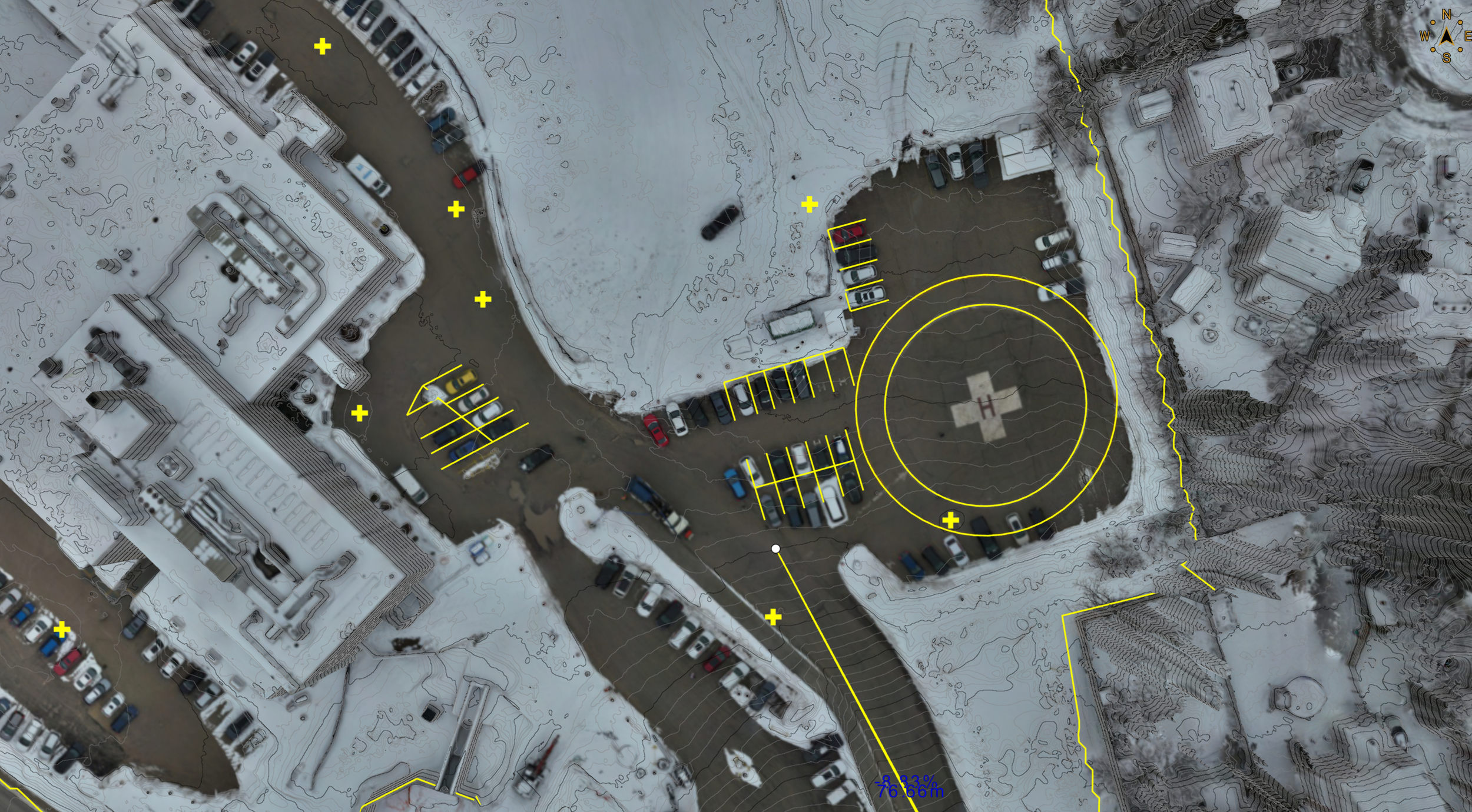
RTK Mapping with Ground Control
Accuracy matters — which is why we use Real-Time Kinematic (RTK) corrections along with Ground Control Points (GCPs) and checkpoints.
Achieve 1–3 cm accuracy, meeting survey-grade standards
Reduce post-processing errors with live correction streams (NTRIP)
Ensure data integrity across large and complex projects
Trusted workflows that let you stand behind your data with confidence
-
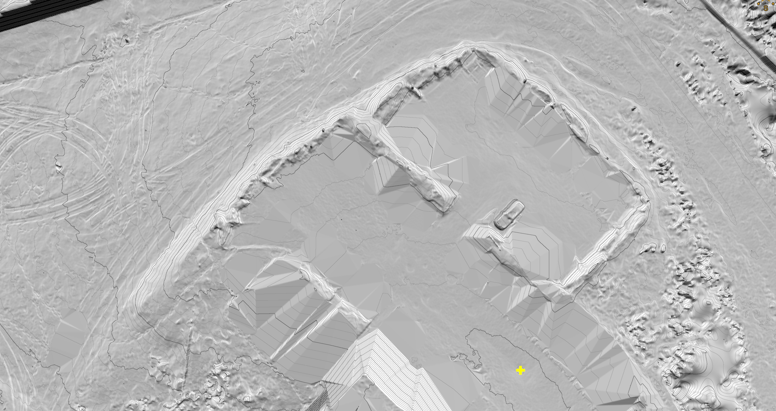
Topographic Mapping
Our topographic surveys provide detailed elevation data essential for engineering and design.
Generate contour maps for drainage, grading, and site planning
Support civil engineering, mining, and infrastructure development
Replace costly manual surveying with faster, safer drone workflows
Export in industry-standard formats (CAD, GIS, Civil 3D)
-
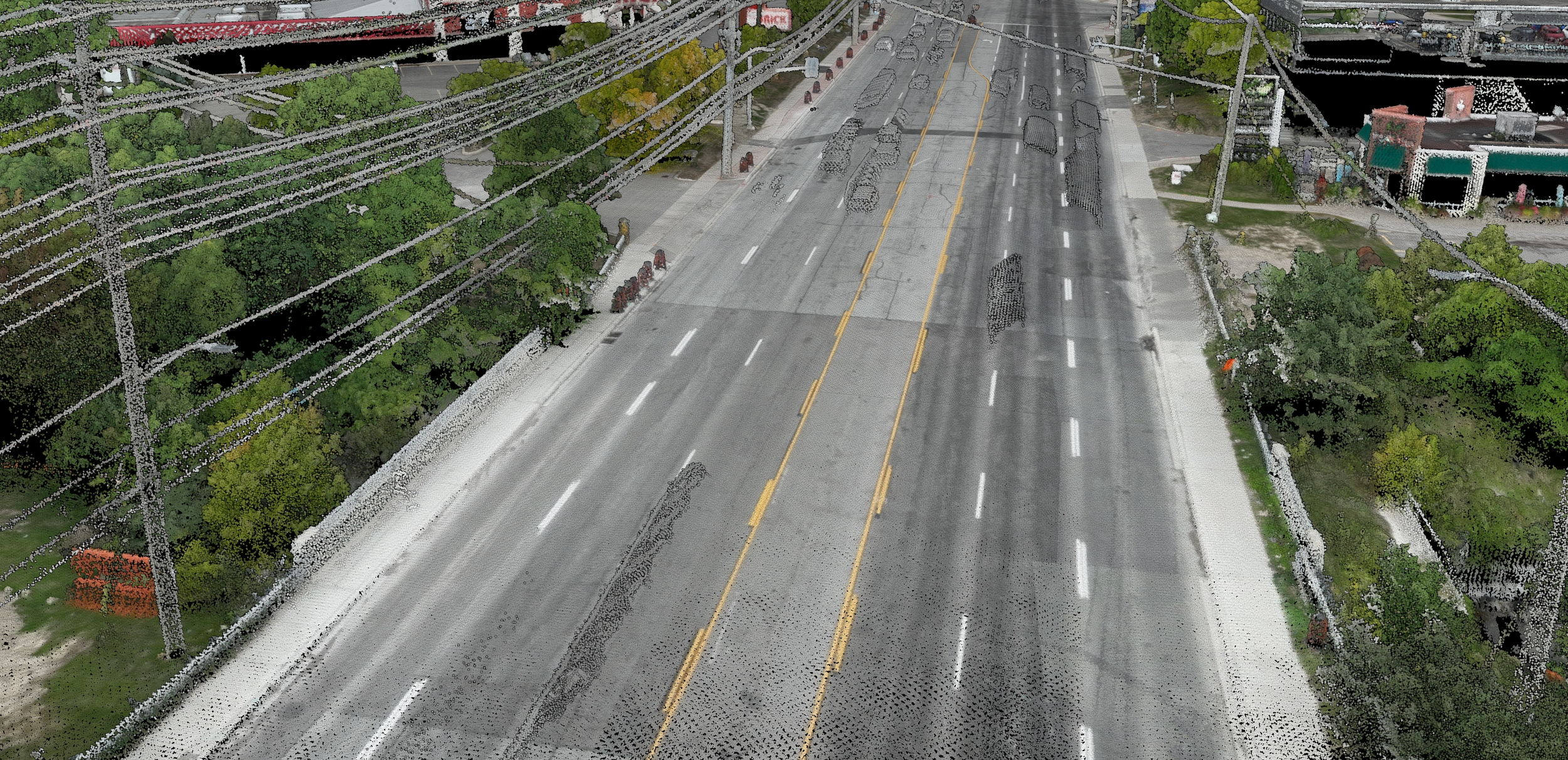
LiDAR Point Clouds
LiDAR technology captures millions of precise 3D points, providing unmatched detail of terrain, structures, and vegetation. Unlike traditional photogrammetry, LiDAR penetrates tree canopies to reveal true ground surfaces, making it ideal for complex environments.
Generate accurate Digital Terrain Models (DTM) and Digital Surface Models (DSM)
Measure stockpiles, pits, and cut/fill volumes with survey-grade precision
Map dense forests, utilities, and infrastructure with vegetation penetration
Export classified point clouds ready for CAD, GIS, and BIM integration
Why Choose Elev8 Visions for Mapping?
Survey-grade accuracy – With RTK, GCPs, and proven workflows.
Faster turnaround – Large sites mapped and processed in record time.
Scalable solutions – From small sites to multi-kilometer corridors.
Data you can use – Deliverables tailored to your workflows: CAD, GIS, BIM, and more.
